- Joined
- Nov 26, 2020
- Messages
- 35
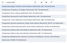
The GSA product suite offers the possibility to incorporate different types of geolocation services that are provided by well known service providers. Examples of such services are the basemap service; provides a background of geographical context for the content you want to display in a map, the geocoding service; the process of converting addresses (like a street address) into geographic coordinates (like latitude and longitude), which you can use to place markers on a map, or position the map and the direction service; Return multi-part directions for a series of waypoints with the possibility to switch between several modes of transportation.
This article will help you select the right basemap, directions, geolocator and street level imagery provider for your next project with the GSA product suite.
Google Maps and Street View (raster basemap service for desktop and web)
There are four types of maps available within the Google Maps service;

Google Street View uses the same service as maps and additionally provides panoramic 360 degree views from designated roads throughout its coverage area.he list of currently supported cities for Street View is available at the Google Maps website.

Google Direction (direction service for desktop and web)
Google's direction service returns multi-part directions for a series of waypoints with the possibility to switch between several modes of transportation.

Google Geocoding (geocoding service for desktop and web)
This service converts addresses (like a street address) into geographic coordinates (like latitude and longitude), which you can use to place markers on a map, or position the map.

To get the API key for the Google services (applicable for corporate or commercial use) you can contact your General Electric representative.
Bing Maps (raster basemap service for desktop and web)
There are three types of maps available within the Bing Maps service;

Bing Geocoding (geocoding service for desktop and web)
This service converts addresses (like a street address) into geographic coordinates (like latitude and longitude), which you can use to place markers on a map, or position the map.

To get the API key for these services (applicable for corporate or commercial use) visit the Microsoft Licensing Website.
OpenStreetMap (raster basemap and geocoding service for desktop and web)
The OpenStreetMap foundation is a non-profit foundation whose aim is to support and enable the development of freely-reusable geospatial data. Read the policy for the use of the public tile and geocoding service. Basemap is available in two types; OpenstreetMap and OpenCycleMap.


See the overview of commercial OpenStreetMap software of services.
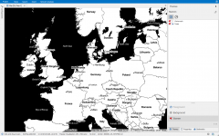
Stamen Maps (raster basemap service for desktop and web)
These map tiles are free to use and are made available as part of the CityTracking project, funded by the Knight Foundation, in which Stamen is building web services and open source tool to display public data in easy-to-understand, highly visual ways.
There are three types of maps available within the Stamen Maps service;

ESRI Basemaps (raster basemap service for desktop and web)
Esri features a variety of publicly available basemaps. There are three types that can be used for general mapping and visualization purposes.

Mapbox Maps (vector basemap service for web)
Mapbox offers vector maps, an advanced approach to mapping where data is delivered to the device and precisely rendered in real-time in the application. The result is smooth and a fast map. You can choose from one of the default designed maps or customize the map yourself in the Mapbox Studio (overview). Satellite imagery is available in raster format.

Mapbox offers different kinds of plans for commercial/corporate users, see the Plan and Pricing overview on their website.
MapTiler (vector basemap service for web)
MapTiler provides the possibility to setup your own OpenStreetMap tileserver using open source software (including weekly updates) or use the commercial vector tile hosting services. Because of the vector format of the basemap multiple styles of the map are available.

CycloMedia (street level imagery for desktop)
CycloMedia provides a cloud-based solution for street level imagery with GIS accuracy. The integration with the Spatial Eye desktop suite enables advanced possibilities to place the configured spatial data (point, line and polygon) in to the street level imagery.

Check the CycloMedia website for the available coverage of the street level imagery or go to the contact page to request a license.
This article will help you select the right basemap, directions, geolocator and street level imagery provider for your next project with the GSA product suite.
Google Maps and Street View (raster basemap service for desktop and web)
There are four types of maps available within the Google Maps service;
- Roadmap displays the default road map view. This is the default map type.
- Satellite displays Google Earth satellite images
- Hybrid displays a mixture of normal and satellite views
- Terrain displays a physical map based on terrain information.
Google Street View uses the same service as maps and additionally provides panoramic 360 degree views from designated roads throughout its coverage area.he list of currently supported cities for Street View is available at the Google Maps website.
Google Direction (direction service for desktop and web)
Google's direction service returns multi-part directions for a series of waypoints with the possibility to switch between several modes of transportation.
Google Geocoding (geocoding service for desktop and web)
This service converts addresses (like a street address) into geographic coordinates (like latitude and longitude), which you can use to place markers on a map, or position the map.
To get the API key for the Google services (applicable for corporate or commercial use) you can contact your General Electric representative.
Bing Maps (raster basemap service for desktop and web)
There are three types of maps available within the Bing Maps service;
- Road displays the default road map view. This is the default map type.
- Aerial displays Bing Aerial images
- Hybrid displays a mixture of normal and Aerial views
Bing Geocoding (geocoding service for desktop and web)
This service converts addresses (like a street address) into geographic coordinates (like latitude and longitude), which you can use to place markers on a map, or position the map.
To get the API key for these services (applicable for corporate or commercial use) visit the Microsoft Licensing Website.
OpenStreetMap (raster basemap and geocoding service for desktop and web)
The OpenStreetMap foundation is a non-profit foundation whose aim is to support and enable the development of freely-reusable geospatial data. Read the policy for the use of the public tile and geocoding service. Basemap is available in two types; OpenstreetMap and OpenCycleMap.
See the overview of commercial OpenStreetMap software of services.
Stamen Maps (raster basemap service for desktop and web)
These map tiles are free to use and are made available as part of the CityTracking project, funded by the Knight Foundation, in which Stamen is building web services and open source tool to display public data in easy-to-understand, highly visual ways.
There are three types of maps available within the Stamen Maps service;
- Toner high-contrast black and white map perfect for mashups and exploring river meanders and coastal zones.
- Terrain a basemap with hill shading and natural vegetation colors.
- Watercolor reminiscent of hand drawn maps, the watercolor map applies raster effect area washes and organic edges over a paper texture to add warm pop to any map.
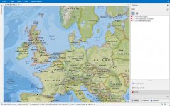
ESRI Basemaps (raster basemap service for desktop and web)
Esri features a variety of publicly available basemaps. There are three types that can be used for general mapping and visualization purposes.
- World Imagery this layer presents satellite imagery for the world and high-resolution imagery for the United States and other areas around the world (description)
- Topographic / Cadastral this world topographic map includes boundaries, cities, water features, physiographic features, parks, landmarks, transportation, and buildings (description)
- National Geographic this map is designed to be used as a general reference map for informational and educational purposes as well as a basemap by GIS professionals and other users for creating web maps and web mapping applications (description)
Mapbox Maps (vector basemap service for web)
Mapbox offers vector maps, an advanced approach to mapping where data is delivered to the device and precisely rendered in real-time in the application. The result is smooth and a fast map. You can choose from one of the default designed maps or customize the map yourself in the Mapbox Studio (overview). Satellite imagery is available in raster format.
Mapbox offers different kinds of plans for commercial/corporate users, see the Plan and Pricing overview on their website.
MapTiler (vector basemap service for web)
MapTiler provides the possibility to setup your own OpenStreetMap tileserver using open source software (including weekly updates) or use the commercial vector tile hosting services. Because of the vector format of the basemap multiple styles of the map are available.
CycloMedia (street level imagery for desktop)
CycloMedia provides a cloud-based solution for street level imagery with GIS accuracy. The integration with the Spatial Eye desktop suite enables advanced possibilities to place the configured spatial data (point, line and polygon) in to the street level imagery.
Check the CycloMedia website for the available coverage of the street level imagery or go to the contact page to request a license.
Attachments
Last edited: