- Joined
- Nov 4, 2020
- Messages
- 1
Hi,
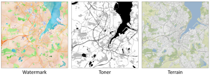
I made an extension of the Stamen service provider. In addition to the Watermark and Toner map types, Stamen now also offer a Terrain map type.

In order to be able to use this additional map type in GSA, the necessary icons must be generated (folder .\GE\GeoSpatial Analysis 5.3.1\ServiceProviders\Stamen) and the ServiceProviders.xml file must be supplemented.
After that, the new map type will be available in GSA.
Kind regards,
Tobias
I made an extension of the Stamen service provider. In addition to the Watermark and Toner map types, Stamen now also offer a Terrain map type.

In order to be able to use this additional map type in GSA, the necessary icons must be generated (folder .\GE\GeoSpatial Analysis 5.3.1\ServiceProviders\Stamen) and the ServiceProviders.xml file must be supplemented.
After that, the new map type will be available in GSA.
Kind regards,
Tobias
